
Tadiandamol Peak Trek, standing 1,748 m high from sea level, is the third-highest Peak in Karnataka. Known facts apart, here are the 7 Stages of experiences Tadiandamol Peak Trek gives you!
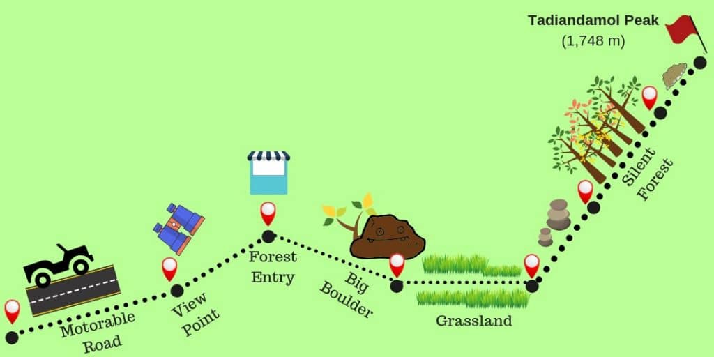
Table of Contents
First, Motorable Tar Road
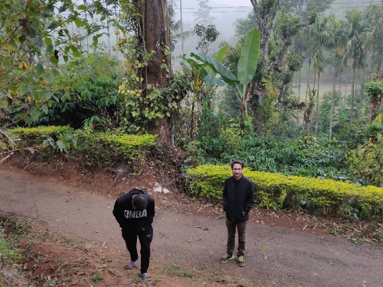
This road extends for around 2.75 km starting from a drop-off point, beyond which the only ways of traversal are by a Jeep or a high-powered geared bike, and on foot.
This stretch of the trail ends at a Viewpoint. You’ll also cross by the highest and oldest trees in this part of the trail. Along the path are local residents’ huts, Orange, Coffee, Pepper, and Cardamom plantations. You will even come across tiny cafes serving tropical fruits, Maggie, and basic beverages.
Second, Paved Road
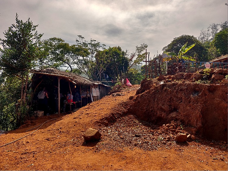
This part of the trail is only traversable on foot. The flora transitions from man-planted to natural outgrowths. The part of the hike ends at a barrelled gate with a Forest Department office guarding it. One must take valid permissions from here before proceeding further on.
This is also the last point where you may fuel up and fill in drinking water. Moving further, there are no dwellings/ stores of any kind.
Third, Downward-Sloped Dirt road.

Ferns, Shrubs, and Bushes wrap the trail, with a few trees here and there. You’d cross by a few waterfalls and even an alley formed by natural foliage.
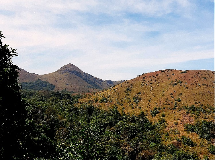
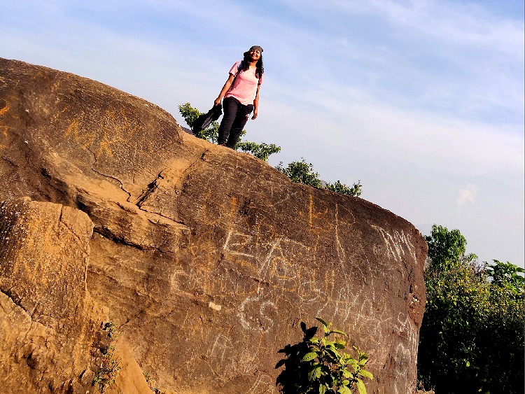
The path ends at a plane valley, from where you can view the peak for the first time. Along the trail are eroded mud walls on the hillside, where, if you observe closely you may spot various species of microgreen ferns, algae, and florets. The path ends at a Huge boulder, which also marks the beginning of the next phase of your hike.
Fourth, Grasslands
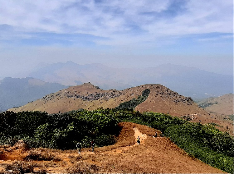
A clear view of the entire valley with no tall trees blocking the scenery, very sunny too. Although the path has a flat orientation, and easy to hike, the scorching sun may make it harder to cover. This makes for a good spot to grab some pictures with the destination pic in the background. The grassland is a lush green and verse carpet allowing the hikers to take breaks and power up for the journey ahead.
Fifth, Boulders & Pebbles

As we see the peak closing by, the route gets a little harder to traverse. Pebbles, stones, and boulders of all sizes carpet the trail.
One must be alert and careful not to step on loose bundles. As can be seen, a hiking pole or walking stick is quite a lot of assistance to help you be extra careful. At times, you may have to crawl on all 4 limbs to push yourself ahead.
Sixth, Dense patch of Forest, trail foiled with Roots
This thicket feels like a world apart from the rest of the trek. The foliage is so dense that barely any sunlight passes to the ground. The peak is no longer visible from here. Silence and serenity personified with mild chirps and cooing of little birds and crickets. Particularly, the trail here resembles a gradual staircase with the steps lined with thick and strong roots of the trees.
Seventh, Slippery & Loose Soil track
Natural thrill at its best, this is where you truly begin appreciating your decision to do the Tadiandamol Trek! Step with great tact and, you’ll reach the top without a single drop. Although slipping, tumbling, and rolling over is quite inevitable on the loosely held soil here.
Owing to the high altitude winds and weathering, the small stretch is as hard to cover albeit how small it may seem. The trick is, to walk over dried grass and even hold them for support at times. But, no trick works perfectly, one may discover their unique trick on what works at the moment.
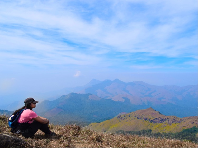
Lastly, The Mighty Peak
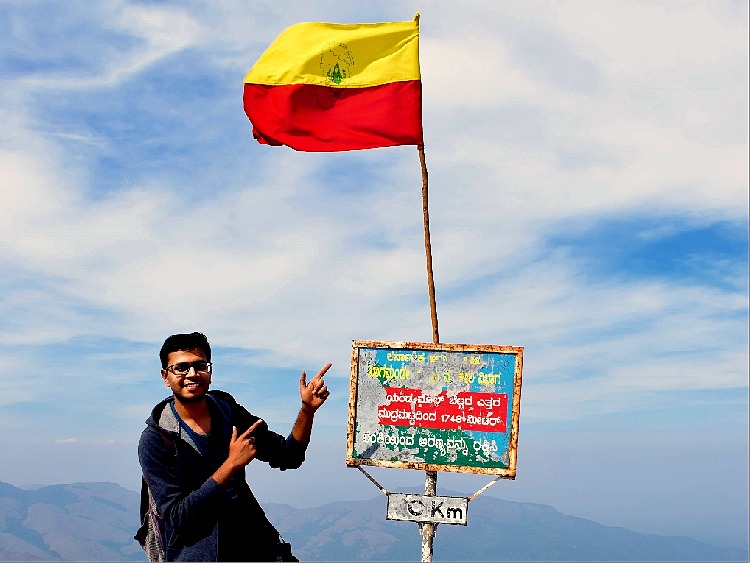
The benevolent view pays off for every drop of sweat shed, every bruise and scratch on your joints, and not to forget the criminal blisters. As you gaze over the untouched valleys, the charm seems to numb anything else that might otherwise be bothering you.
Everyone waits their turn to get a picture with the flag mounted on the peak, and a milestone that says ” Zero km”. Trust me, nothing is more satisfying than the perfectly placed Zero to mark the peak.
Looking for similar treks around Bangalore? checkout the Bangalore Calendar! I highly recommend the Vattakanal Trek, and, if you’re craving some Sea, then Gokarna is your must go to next.


